aSURE: The Definitive Fluid Map
aSURE displays the location of fluids and the best reservoir facies on maps, all in an easily understandable 2D display, for any desired horizon. This allows to see how reservoirs and fluids behave at different depths.
The reservoirs to be analyzed do not need to have been previously drilled, as we use calibration from wells in the regions to ensure the highest level of accuracy. aSURE works in any type of sedimentary basin, whether onshore or offshore. With it, you can decide where to drill to make the most of your E&P projects.

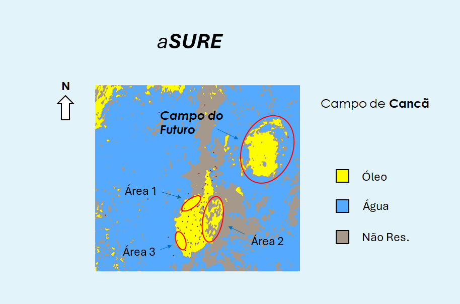
Fluid Map of Cancã Field
Take a look at the fluid map of Cancã Field, located onshore in Espírito Santo Basin. It depicts São Mateus Sandstone with its faciological variations and helps you choose three optimal areas to drill new wells and breathe new life into the field. The revitalization of Mature Fields becomes much safer and more efficient; and there's more: it shows a new exploratory area, which has not yet been drilled, which we call the "Field of the Future", an oil field discovered solely with the aSURE platform. This map is proof of the power of aSURE technology to provide you with accurate and reliable information for oil and gas exploration and production.
